
Sea Areas, Navigation Periods and applicable Classes
Passenger ships are divided into the following classes according to the sea area in which they may operate:
Class A - means a passenger ship engaged on domestic voyages in Areas A, B, C and D
Class B - means a passenger ship engaged on domestic voyages in Areas B, C and D.
Class C - means a passenger ship engaged on domestic voyages in Areas C and D.
Class D - means a passenger ship engaged on domestic voyages in Area D.
The Sea areas are divided into the following categories:
- Sea area A – means a sea area outside of areas B, C and D.
- Sea area B – means a sea area, whose geographical coordinates are at no point more than 20 miles from the line of coast, corresponding to the medium tide height, but which is outside of areas C and D.
- Sea area C – means a sea area, whose geographical coordinates are at any point no more than 5 miles from the line of coast, corresponding to the medium tide height, but outside of sea area D if any. Additionally the probability of the significant wave height exceeding 2,5 metres shall be smaller than 10 % for a period of one year for all-year-round operation, or for a specific period for seasonal operation, such as summer period operation.
- Sea area D – means a sea area, whose geographical coordinates are at any point no more than 3 miles from the line of coast, corresponding to the medium tide height. Additionally the probability of the significant wave height exceeding 1,5 metres shall be smaller than 10 % for a period of one year for all-year-round operation, or for a specific period for seasonal operation, such as summer period operation
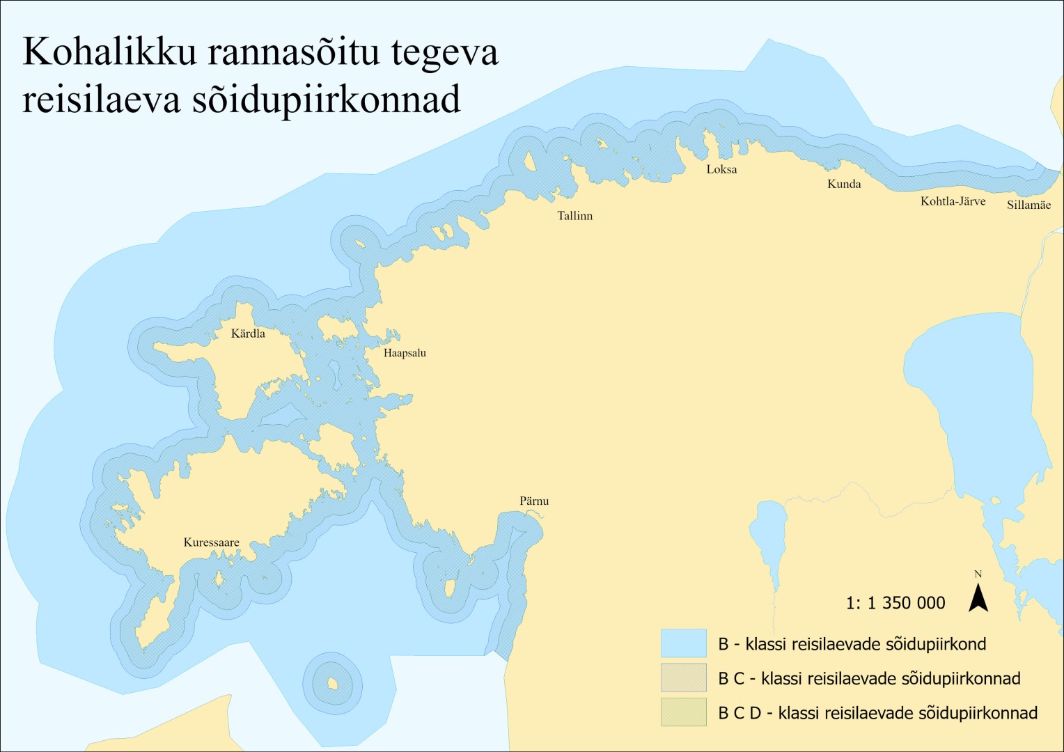
More specifically, the voyage at sea areas within Estonian jurisdiction are described for navigation between the respective ports.
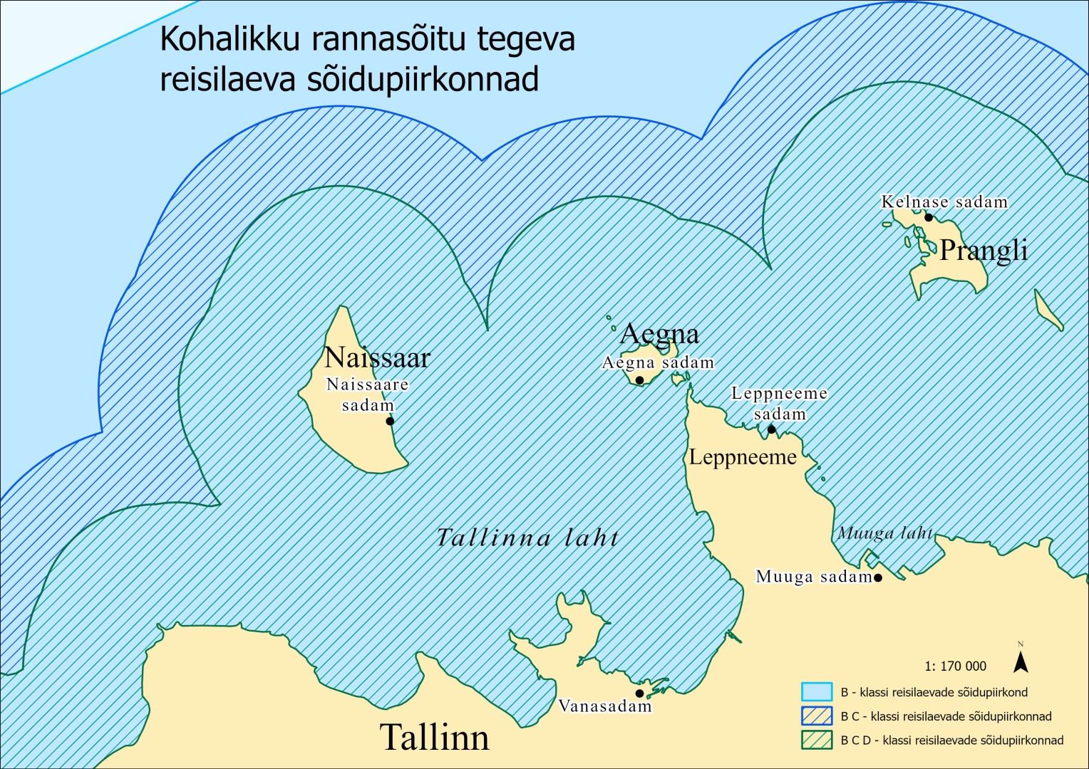
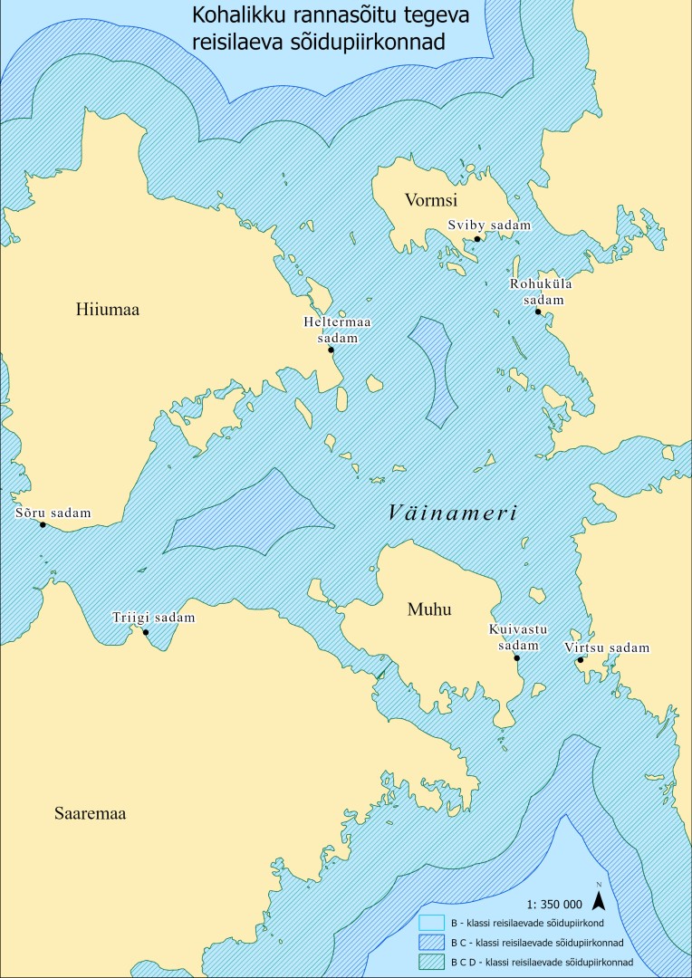
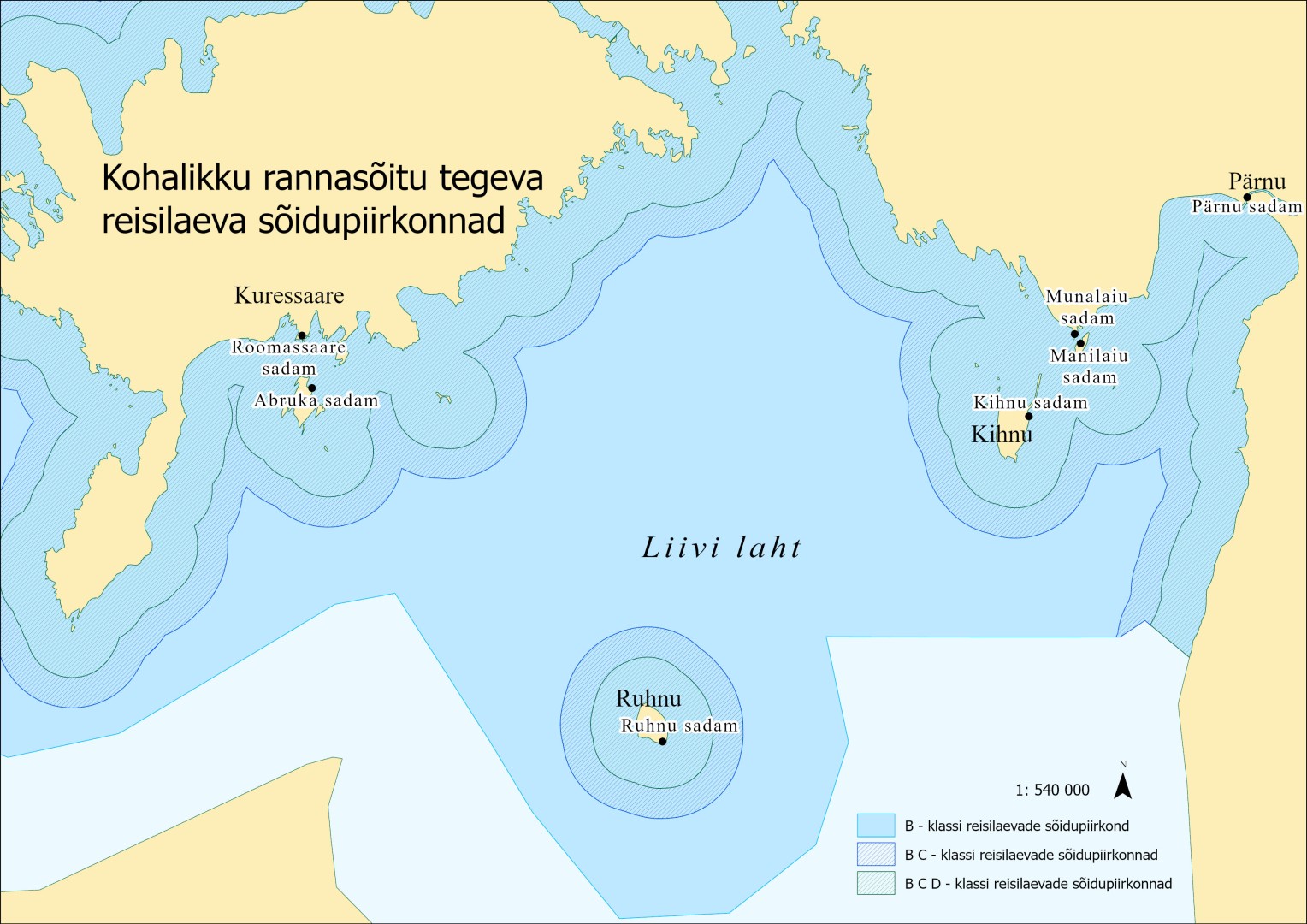
For inland waters connected to the sea, the inner border of the sea area is the straight line connecting the seaward ends of the breakwaters or the ends of any sea facing rivers.
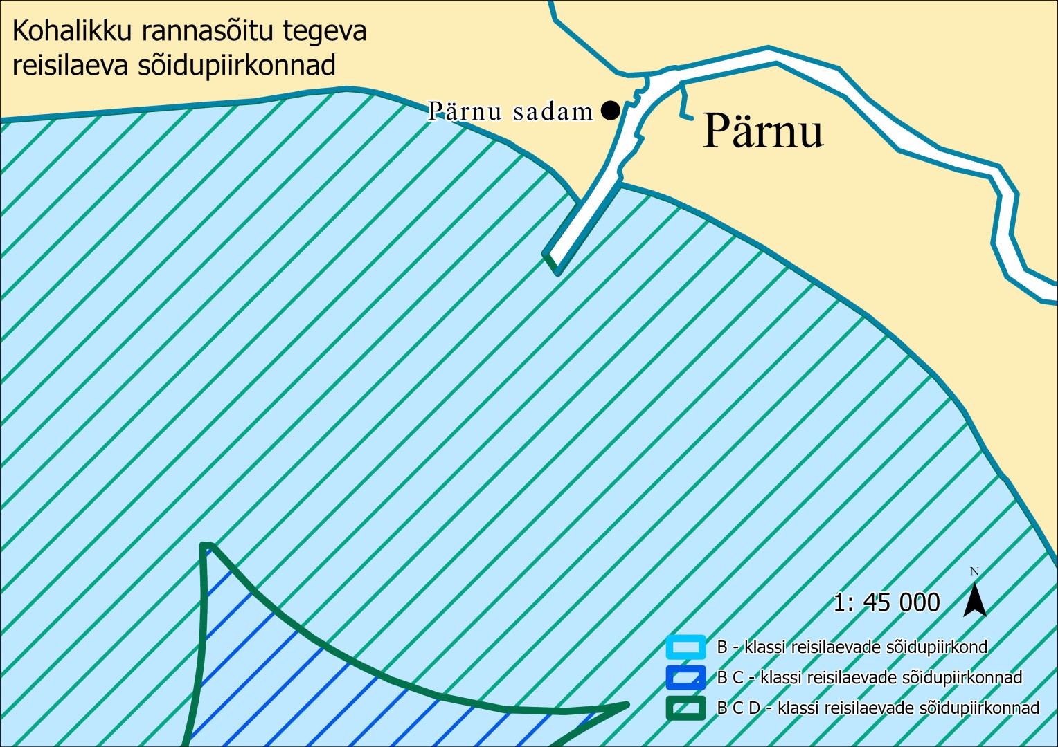
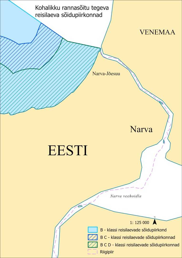
The sea areas, navigation periods and the classes of passenger ships permitted to operate in specific routes are as follows:
1)Tallinn Bay: Naissaar, Aegna – throughout the year: Class A, B, C and D passenger ships. Leppneeme–Prangli – throughout the year: Class A, B, C and D passenger ships.
2)Väinameri: Virtsu–Kuivastu and Rohuküla–Sviby – throughout the year: Class A, B, C and D passenger ships. Rohuküla–Heltermaa – throughout the year: 3)Class A, B and C passenger ships; during the summer navigation period: Class D passenger ships.
4)Saaremaa–Hiiumaa: Triigi–Sõru – throughout the year: Class A, B, C and D passenger ships.
5)Roomassaare–Abruka – throughout the year: Class A, B, C and D passenger ships.
6)Roomassaare–Ruhnu and Pärnu–Ruhnu – throughout the year: Class A and B passenger ships.
7)Munalaid–Manilaid–Kihnu – throughout the year: Class A, B, C and D passenger ships.
8)Pärnu–Kihnu – throughout the year: Class A, B and C passenger ships; during the summer navigation period: Class D passenger ships.
Last updated: 01.10.2026

